
August 25, 2006
Air Date: August 25, 2006
FULL SHOW
SEGMENTS
Rebuilding Levees, Rebuilding Neighborhoods
/ Jeff YoungView the page for this story
It's been a year since Hurricane Katrina drowned New Orleans. Now returning residents wonder if the levees that failed in that storm will protect them. Living on Earth's Jeff Young reports on the levee repairs. (12:00)
A Checkered Past
/ Jeff YoungView the page for this story
How did New Orleans end up with such a flawed storm protection system? Living on Earth's Jeff Young traces the history of the region's levees and finds misplaced priorities, political squabbles and a coastline sinking around the rising floodwalls. (18:30)
Future Outlook
/ Steve CurwoodView the page for this story
There are a number of engineering plans on the drawing board that aim to give New Orleans and the Gulf Coast the level of protection they need to fend off hurricanes. Host Steve Curwood examines the feasibility, practicality, and cost to implement some of the major proposals. (17:10)
Show Credits and Funders
Show Transcript
HOST: Steve Curwood
REPORTER: Jeff Young
[THEME MUSIC]
CURWOOD: From NPR - this is Living on Earth.
[THEME MUSIC UP AND UNDER]
CURWOOD: I’m Steve Curwood.
So far this hurricane season, the levee systems and eroded coastal wetlands of New Orleans and Southern Louisiana have yet to face the challenge of another Katrina. But as the government and some homeowners race to rebuild a year after the massive flooding disaster, there are still questions about the best ways to make sure the levees don’t fail again. Yet, out of the devastation there’s a new determination that answers will be found.
DUFRECHOU: There’s a part of me that stopped living on Aug 29 and another part that‘s still here. The part that’s still here is the part that knows we can change it, that we can make this community sustainable, and we can do it right. (recovers emotionally) Um, (sigh), and anyway what we have to do at this point is just to make the area sustainable. And dadgummit, we’re gonna do it.
CURWOOD: Storm protection—past, present, and future, this week on Living on Earth.
Stick around.
[THEME MUSIC]
ANNOUNCER: Support for Living on Earth comes from the National Science Foundation and Stonyfield Farm.
Rebuilding Levees, Rebuilding Neighborhoods
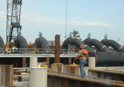
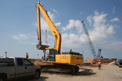
Construction of floodgates and pumps at the 17th St. and London Ave. Canal, August 2006.(Photo: Nancy Allen, USACE)
CURWOOD: This is Living on Earth. I’m Steve Curwood in New Orleans.
[MUSIC: Charlie Miller "Prayer for New Orleans" from ‘Our New Orleans’ (Sony –1929)]
CURWOOD: It’s been a year since Hurricane Katrina rolled through New Orleans. But in many parts of the city you wouldn’t know a year has passed. A year later the high water marks still stain block after block of damaged homes. A year later the deficient floodwalls are still under repair. A year later and it’s almost as if time has stood still.
For Mississippi and Alabama, Katrina was a historic natural disaster—a massive Category 5 hurricane that obliterated the coast. But for New Orleans it was a man-made catastrophe. By the time the storm reached here the winds and surge had weakened to within the design criteria of the levees meant to protect the city. Yet those levees failed on August 29th in the largest civil engineering disaster in American history.
Construction of floodgates and pumps at the 17th St. and London Ave. Canal, August 2006. When the work is completed, five foot diameter pipes will carry rainwater around the floodgates and into Lake Pontchartrain. (Photo: Nancy Allen, USACE)
[HAMMERING]
YOUNG: New Orleans lawyer Jim Cobb tucks a six-pack of beer under each arm as he
checks on his house. The sound of construction is a rare sign of progress in the neighborhood.
COBB: We have floors, we have walls, and paint on the walls. That puts us ahead of 99 percent of people in Lakeview.
[MORE HAMMERING]
YOUNG: The beer is for his workers—with demand for labor so high, he wants to keep them happy. He could use a beer himself. Cobb has the look of someone who’s seen too much and slept too little lately. But what he sees now looks pretty good. The mold and urine-colored stain of high water are gone. Cabinets are going in the kitchen. The house is almost ready for his family of four to return.
COBB: We’ve been here for 10 years. Very happy until August 29, 2005 at about 10:35 a.m. and been unhappy since.
YOUNG: That, of course, was when Hurricane Katrina showed New Orleans just how vulnerable it was. This neighborhood flooded when the eastern levee on the drainage canal along 17th Street failed. Cobb says the past year brought a lot of frustration and pain and little in the way of planning, leadership or financial assistance. He’s eager to get back home, even if it’s to one he hardly recognizes.
COBB: There’s no place to eat, there’s no grocery stores, there’s no pharmacy. We’ve been failed by every level of government for so long that as a citizen you don’t believe anything any of them say. Those of us who are left have decided we’re gonna do it on our own and just give me gas and water and electricity and I’ll see you later.
YOUNG: What’s you’re feeling toward the Army Corps of Engineers now? I mean, your home was resting behind these levees that you obviously had some faith in or you wouldn’t have made the investment in this house here. What do you think of the Army Corps?
COBB: That I can say on the radio? Uh, nothing good. Nothing good.
YOUNG: Well, here you are rebuilding. You’re essentially trusting them to protect you this time around, what’s different?
COBB: What’s different now is that they should be and ought to be horribly humiliated for what they let happen here. And I’m hopeful that they will not let it happen again.
[DEMOLITION SOUND]
YOUNG: The last remnants of homes are still being demolished along the 17th Street canal where the levee failed. Steel pilings block the football-field sized hole in the floodwall and levee.
[SOUND OF CORPS WORK AREA]
YOUNG: Nearby, the canal empties into Lake Pontchartrain. That’s where the Army
Corps is still at work on a dramatic feat of emergency engineering.
HITCHINGS: Yeah, what you see in the farthest distance is what appears to be a big black wall. Those are the gates and when they’re closed they will prevent the water from coming into the canal.
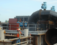
These large pipes will carry rainwater from the 17th street canal around the new floodgate. There are nagging concerns about whether it will be enough to avoid future flooding. (Photo: Nancy Allen, USACE)
HITCHINGS: We’re fearful that if the lake level rose to the point that it would in a severe storm that it would threaten those walls. So those gates will close and it will just keep the water out. The problem that that creates is that when gates are closed they can’t run the pumps to pump the water out of the city.
YOUNG: Because much of New Orleans is below sea level, rainwater must be pumped out. So, just to the sides of the new gates the Corps is installing more pumps and five foot diameter pipes. In a storm, the closed gates would keep surge from entering while the pumps and pipes would let rainwater exit. There are nagging concerns about the pumping capacity. But Hitchings is confident this mix of gates and pumps will keep the city’s drainage canals from causing more catastrophic flooding.
Other levees are being armored with rock or concrete to keep them from eroding if water spills over the top. But there are other problems to deal with. A recent study in the journal Nature showed the land under the entire region is subsiding at a much faster rate than thought. That means many levees are much lower than they should be.
HITCHINGS: So we’ve got 36 miles of floodwalls that over the next two years we’ll be replacing and building a stronger floodwall in their place to provide a higher level of protection than what they currently have. Yeah, if we had an exact repeat of Katrina probably you would see levees overtopped. We wouldn’t have the failures that occurred along these outfall canals. The result would be you’d end up with about one third as much water in this part of the city as you did with Katrina. So it’s still gonna put a lot of water in even if levees did not erode away.
[ENTERING A TRAILER]
YOUNG: K.C. and Kathy King used to have a house right against one of the levees along the London Avenue canal. The levee failed just 8 doors down from them. Now they have a vacant lot with a FEMA trailer and an RV parked on it.
The Kings are among the few people on their quiet, tree-lined drive to rebuild. This time, they’re building higher.
K.C. and Kathy King on the lot where their house stood before the London Avenue Canal levee broke. They plan to build their new home higher than the floodwaters reached—eight feet high. (Photo: Jeff Young)
YOUNG: The government now requires that homes here be three feet above ground level and there’s money to help pay for the construction. But here’s the catch: if you want to go higher, as the Kings do, you have to pay for that extra work yourself. King says it’s worth it because he does not trust the Corps of Engineers.
KING: There’s no evidence they’ve learned and are taking that knowledge and putting it back into reforming the organization, the institution itself. Because that’s what produced it. It wasn’t some disembodied bad decision. It was an institution behaving badly.
YOUNG: King’s not the only one who’d like to see the Corps make some changes. University of California at Berkeley engineering professor Bob Bea was part of a team funded by the National Science Foundation to investigate the levee failures. Bea has praise for the Corps’ work since the storm but scathing criticism for the work that led up to it.
BEA: The Corps is doing, I think, a heroic job to make these intermediate repairs. But if you don’t fix the organizational system that’s responsible for designing constructing operating and maintaining that, you’re not going to win the battle with nature.
YOUNG: Bea brings a unique perspective to both the Corps and the city. He worked for the Corps, as did his father. And Bea lived in New Orleans in 1965 when Hurricane Betsy destroyed his home.
BEA: I looked at this problem ,I think, very, very differently than many of my colleagues and could see very deeply into the eyes of those people that lost so much. I was able to pretty well see what was going on with my old family, the Corps of Engineers, that kept reminding me of how a good family can turn out to not be what we really want.
YOUNG: In short, Bea found his old family, the Corps, had become dysfunctional. He recommends more independent review and oversight of Corps projects and major changes in the way the Corps interacts with Congress, local government sponsors, and industry to set priorities. Major General Don Riley is head of civil engineering for the Army Corps. Riley agrees with most of the technical aspects of Bea’s report on levee failures.
RILEY: Those failed prior to reaching their design height of protection so there’s four engineering failures in particular that we’re highly concerned about. We are certainly accountable for those failures.
YOUNG: What does that mean exactly when you say we’re accountable—have people been fired, demoted, reprimanded in any way?
RILEY: No they haven’t. Now what it means is we’re accountable. We’ll go back and look at all the investigative work that we’ve been doing those reports will come out pretty soon. There’ll be a lot more questions asked and improvements made across the board in all the systems.
YOUNG: Riley says he supports more independent review of Corps work, but he’s less enthusiastic about other recommended changes, saying he sees no need to change the way the Corps works with Congress.
[POWER SAW/CONSTRUCTION NOISE]
YOUNG: In the Upper Ninth Ward of New Orleans, Habitat for Humanity volunteers are working to build, not just new homes but a new neighborhood. They call it the Musicians Village, and Michael Harris will be among its first residents.
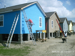
The colorful new homes of the Habitat for Humanity Musicians Village project in New Orleans. Musician and father Michael Harris says it’s an answer to his dreams. (Photo: Jeff Young)
HARRIS: I think this is going to be one of the many incubators for our culture and our heritage and tradition. This program is an answer to all my prayers in so many ways and so many levels.
YOUNG: Harris will live in one of the project’s colorful, cozy homes with his teenage son. He’s clearly excited about the new neighborhood, but he’s uneasy about the Corps’ levees and floodwalls that must protect it.
HARRIS: [GROANS, LAUGHS] If I go just by their track record, then it doesn’t look good. Will it flood again? We have the technology to prevent it. We have the technology, that’s proven beyond the shadow of a doubt. Will it be applied? That remains to be seen.
Related links:
- U.S. Army Corps of Engineers – Hurricane Protection System
- Interagency Performance Evaluation Taskforce Post-Katrina Report
- Levees.org – New Orleans Citizens Group
- University of Calif./Berkeley Final Report on New Orleans Flood Protection Systems (July 31, 2006)
- Habitat for Humanity – New Orleans
CURWOOD: Coming up: Jeff Young looks at the history and engineering decisions made long ago that led to the failure of the levees to protect new Orleans. Stay tuned to Living on Earth.
[MUSIC: Tuts Washington "Tee Nah Nah" from ‘Louisiana Spice’ (Rounder – 1995)]
A Checkered Past
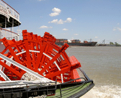
From sternwheelers to cargo ships, commerce on the Mississippi built New Orleans. The river also built all of southeast Louisiana's land. (Photo: Jeff Young)
CURWOOD: It’s Living on Earth. I’m Steve Curwood. By now it’s clear that Hurricane Katrina did not drown New Orleans by herself. The city flooded because its levees and floodwalls failed in the face of a challenge they should have contained.
Those walls against the water were tangible expressions of a community’s trust. People trusted their homes, belongings – their very lives – to a hurricane protection system that was 40 years in the making and then undone in a day.
Living on Earth’s Jeff Young continues his report now with a look at how that flawed levee system came about. It’s a history full of skewed priorities, political squabbles and unintended consequences for a river, the land it built, and the people who live on it.
From sternwheelers to cargo ships, commerce on the Mississippi built New Orleans. The river also built all of southeast Louisiana's land. (Photo: Jeff Young)
YOUNG: The Mississippi River built New Orleans.
[STERNWHEELER WHISTLE BLOWS, MORE CHURNING WATER]
YOUNG: From sternwheelers like this one to today’s ocean going vessels, commerce on the river made New Orleans one of the country’s busiest ports. But the river built this city in a more literal sense: it actually made all this land.
REED: Oh yeah, the whole of southeast Louisiana was built by the river.
YOUNG: Wetlands ecologist Denise Reed sits by the river across town from where she teaches at the University of New Orleans. Reed explains how for millennia the Mississippi picked up sediment from its enormous drainage and left it here.
REED: About every one thousand years or so, we think, the river has built land in one area, then another, then another area. And by the time we stopped it doing that it was going down the location that it presently does through the city of New Orleans. And so we’ve locked it in position now. It doesn’t swing around the coast like a hose pipe building land. When we did that, when we contained the river and tamed it within the levees, there were some unintended consequences.
YOUNG: River delta land is soft and loose and compacts over time. Without more sediment from river floods, the land sinks. And in the past 60 years or so, the marshes have been carved up with canals – thousands of them – for navigation and for the many oil and gas wells and pipelines. That let salt water from the Gulf of Mexico rush in, killing fresh water marsh.
REED: What it means is that we’re sitting on the delta of the sixth largest river in the world and it’s in fundamental decline. Much of the marsh and wetland that we have lost during the 20th century…it’s difficult to envisage how we could get that back. The system is so seriously deteriorated. Some parts of the coast are just not there anymore.
YOUNG: The city sank, and the coast shrank. In an average year Louisiana loses 24 square miles to open water. By 2050 it could lose another 500. That land sheltered migrating birds and one of the country’s richest fisheries. It was also south Louisiana’s buffer against storms raging in from the Gulf of Mexico. But then, people had a pretty good reason to build levees along the river.
[ARCHIVE SOUND NEWSREEL]
NARRATOR: …1927 brought havoc to Mississippi as torrents of water poured through the lowland states from Illinois to the Gulf…
[NEWSREEL MUSIC UNDER]
BARRY: The river was this enormous force. That flood hit the homes of nearly one percent of the entire population of the country.
YOUNG: Historian and New Orleanian John Barry. His book "Rising Tide" tells how the great flood of 1927 changed the region and its relationship with the river.
BARRY: They strengthened the levees significantly after the ’27 flood. They have not had a major flood break those levees since 1927.
YOUNG: Controlling the Mississippi became the top job for the Army Corps of Engineers. University of Maryland engineering professor and retired General Gerald Galloway knows how big a job that was. He served 38 years in the Corps.
GALLOWAY: The Mississippi was the big tiger that they were wrestling with. That’s the front door to New Orleans. The back door was the coastal protection from hurricanes. In 1965 Hurricane Betsy alerted everybody to the fact that you could put New Orleans under water from the back door.
[JOHNSON LIBRARY ARCHIVE TAPE]
LBJ: Is your home under water?
WM: Oh yes, water. About three feet to the house.
LBJ: What's happened to your neighbors?
WM: They the same way, sir. They're the same way.
YOUNG: President Lyndon Johnson comforted storm survivors just after Hurricane Betsy took that "back door" into the city. Water roared up an inland bay called Lake Borgne. From there, it spilled into the city’s east via a canal just completed that year called the Mississippi River Gulf Outlet. Water also swamped the city’s north from Lake Pontchartrain. Johnson pledged federal help.
[LBJ ARCHIVE TAPE]
LBJ: This state will build its way out of its sorrow. And the national government will be at Louisiana's side to help it every step of the way in every way that we can.
[APPLAUSE]
YOUNG: Hurricane Betsy spurred Congress to fund the first Army Corps plan to protect New Orleans from storms. That started 40 years of work on the 125-mile levee system – a system still not finished today. The original plan also called for more: a large storm surge barrier. When open, it would allow boats and normal tidal flow between Lakes Borgne and Pontchartrain. When closed, it would keep storm waters from surging into Pontchartrain and the city’s north. But that plan ran into a different kind of storm. Again, Gerald Galloway:
GALLOWAY: From the very beginning the construction of the hurricane protection system around New Orleans was fraught with lots of challenges.
YOUNG: The first was a lawsuit challenging the surge barrier. Communities on the lake’s north shore worried it would put them in greater danger. And environmentalists argued it would damage the lake ecosystem. A federal judge agreed and sent the surge barrier back to the drawing board in the 70s. Vald Heiberg was district chief of the Corps at the time.
HEIBERG: We, the Corps of Engineers, never got beyond that point. I ended up being the head of the Corps and was the guy a decade later who said, ‘okay, we’re just gonna quit trying. We’ll just try to build those levees in New Orleans higher.’ I don’t know if that was the right idea. As I’ve told some people, that might have been the worst thing I ever did as chief of engineers.
YOUNG: After Katrina, the idea of surge barriers is back and still controversial. A recent report from the Government Accountability Office says it’s likely Katrina’s surge would have overtopped the barrier as it was originally designed. That could have made flooding even worse because the original plan called for lower levees around the city.
But Heiberg and other former high-ranking Corps members insist New Orleans needs a surge barrier. They say a new design, coupled with higher levees, could protect against storms without harming the environment.
In any event, when the surge barrier plan died in the 70’s, the Corps had to rethink its protection for New Orleans. They shifted focus to the city itself and three major weak points: the canals that carry rainwater out to the lake could also let storm surge into the very heart of the city.
BARRY: You know, when you take on your enemy, you generally don’t want to invite the enemy into your living room for the battle. And that’s essentially what happened.
YOUNG: Historian John Barry says the Corps proposed decades ago to put gates where each canal meets the lake – so canals made to drain out didn’t instead allow lake water in - very much like the ones they’re racing to build today. But politics intervened.
BARRY: The local politicians ordered the Corps, through legislation, not to do that because they felt it was too expensive. They didn’t want to pay their share.
YOUNG: With no surge barrier on the lake and no gates on the canals, the only plan left was to simply line the canals with higher levees and walls – levees and walls that fell when Katrina took the same back door to New Orleans that Betsy found open 40 years before. Barry says there’s plenty of blame to go around. But he places most of it squarely on the Army Corps.
BARRY: When the Corps looks at itself in the mirror I think there are some real problems here. There were many compromises that the Corps made. A lot of those compromises were forced upon it, but not all of them. Yeah, I’m pretty disappointed in the work they did.
YOUNG: Of course, that levee work is now the focus of intense scrutiny. But retired Corps General Gerald Galloway says the problems really started before the work began.
GALLOWAY: I would argue that the problem began when we failed to specify the level of protection to be provided.
YOUNG: All along, the Corps’ plan to protect New Orleans was based on a late ‘50s study by The Weather Service guessing the strength of storms most likely to hit. It was called the Standard Project Hurricane.
GALLOWAY: When we picked the Standard Project Hurricane for New Orleans we were picking low, not high. We went in the wrong direction. Instead of taking the biggest storm that we could conjure we took a sort of moderate storm, and, as we’ve seen, the results were disastrous.
YOUNG: The Corps upgraded its storm calculations with a study in the late 70’s. Louisiana State University Hurricane Center Director Ivor Van Heerden says the Army even issued a directive in 1981 to use those new findings and design protection for a stronger storm.
VAN HEERDEN: Unfortunately, the Corps seems to have stayed with the 1959 definition of a Standard Project Hurricane, which was a much, much weaker storm.
YOUNG: They paid for this study. Why didn’t they use it?
VAN HEERDEN: We see cost cutting efforts one after the other. And we see this term in the internal correspondence – about this will cut costs, this will cut costs. So it looks like, perhaps, that the use of a weaker hurricane meant you didn’t have to build levees as robust or as high and as a result you cut your costs.
YOUNG: So was the problem a shortage of money? The storm protection system was still not complete when Katrina hit. And the Bush administration had cut maintenance budgets for levees. But still, Louisiana got more money for Corps projects over the past five years than any other state – nearly two billion dollars. Steve Ellis is with the budget watchdog group Taxpayers for Common Sense.
ELLIS: So it wasn’t that we didn’t spend enough money; it was going to the wrong things. Rather than concentrating our resources and maintaining what we had and trying to actually provide adequate or better flood protection, we were building other things across the state.
YOUNG: Ellis says Corps projects too often waste money and hurt the environment. The Corps says it’s changed to make restoration a major part of its mission. Two Corps projects just a few miles apart provide evidence for both arguments: the Mississippi River Gulf Outlet and the Caernarvan diversion.
[OUTDOORS ON CAERNARVAN LEVEE]
YOUNG: So, I’m walking along the Mississippi River levee downstream of New Orleans at a big bend in the river called English Turn in Saint Bernard’s Parish. There’s a little community called Caernarvan. Now, Caernarvan is locally infamous in history because in 1927, during the Great Flood, the powers that be that ran New Orleans dynamited the levee, right here.
Well, it’s one of those funny coincidences of history that if you visit Caernarvan these days you’ll find there’s another intentional hole in the levee. Listen, you can hear some of the Mississippi River rushing through the levee. This time, the goal is to use that water to save some of the disappearing wetlands.
VILLARUBIA: This is right near the spot where the levee was blown up. And so we’re trying to replicate that, albeit in a much in a smaller way.
Biologist Chuck Villarubia checks the flow at the Caernarvan freshwater diversion. The willows behind him have grown where there was once open saltwater. (Photo: Jeff Young)
VILLARUBIA: What we have is a series of five tubes that are 15 by 15 feet. That then distributes water from the river into the marsh. What this does is help simulate the over-bank flooding that happened before the levees were here.
YOUNG: And are we gonna open the gates here?
VILLARUBIA: Yeah, we can open the gates and show ya how it works.
[SOUND OF RUSHING WATER]
YOUNG: With the gates fully open, 8,000 cubic feet per second of muddy Mississippi rush through. In some parts of the country that would be a river in itself. But it’s spare change here.
[WATER SOUND, THEN SOUND OF BIRDS, A LITTLE WIND]
YOUNG: The river water pushes back saltwater from some abandoned fields. Now the marsh is starting to come back, as is wildlife.
VILLARUBIA: Yeah, that’s him right now. There’s an alligator – that’s a half way decent sized one – kind of checking us out a little bit.
YOUNG: The concern about losing wetlands and the land itself is so great, it must be really satisfying to come here and say, ‘We’re starting to turn the tide,’ at least a little bit.
VILLARUBIA: Caernarvan has been successful. It’s been nice to see it work. And particularly now, after the hurricane, we’ve seen that, and we know that we need to have this marsh in front of these levees to make them more effective. Most of the levees look fine here, at least in this area. So we need to make this wetland restoration work along with levees for the protection of the whole area.
YOUNG: But any excitement over the success of this small project is tempered by hard lessons from its history.
YOUNG: The Corps proposed this diversion in the 60’s but didn’t get it built until the 90’s. Once built, it was nearly derailed by a billion-dollar lawsuit from oystermen who claimed the incoming freshwater damaged oyster beds. And while the corps spent $26 million at Caernarvan to help repair wetlands, it spent many times that on another project which destroys wetlands: the Mississippi River Gulf Outlet.
DUFRECHOU: The Gulf Outlet, in my opinion, has been a cancer.
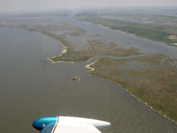
Carlton Dufrechou flies over the project Louisianans love to hate: the Mississippi River Gulf Outlet (MRGO), known locally as Mr. Go. (Photo: Jeff Young)
DUFRECHOU: It bisected the coast. So it was a shortcut for salt water from the higher salinity waters of the gulf into the historically brackish and sometimes fresh water of the upper reaches, closer to New Orleans, eating away at our natural lines of defense down there, day in and day out.
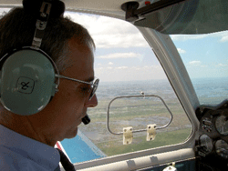
YOUNG: Dufrechou says the best way to see all this is from the air.
DUFRECHOU: Clear prop!
[AIRPLANE ENGINE STARTS UP]
Land loss left the old Martello Castle with nothing but walls against the water. Will New Orleans wind up the same way? (Photo: Jeff Young)
DUFRECHOU: And here we go.
YOUNG: When the Corps first dug the MRGO it was about 700 feet at its widest. But the soft banks eroded with each dredging, and salt water intruded. Over the decades it spread to more than 2,000 feet wide, destroying at least 27,000 acres of wetlands.
DUFRECHOU [ON HEADSET]: Okay, so that channel right there is the Mississippi River Gulf Outlet. You get an appreciation of how much it’s opened up.
YOUNG: To the south of the MRGO we see the many repair jobs where the channel’s levee breached during Katrina, wiping out communities in St Bernard’s Parish. To its north, what’s left of the marshland looks to be melting away into Lake Borgne. Dufrechou points to an odd rectangle of stone in the shining water.
DUFRECHOU [ON HEADSET]: Right down here, that thing in the water, that used to be a fort. And that used to be land around it. Used to be land that you could walk to, take a boat to.
YOUNG: Wow.
DUFRECHOU: Now you have to take a boat to it.
YOUNG: The fort’s thick rock walls protected it since before the Civil War. But walls were no match for rising water and sinking land. It’s like looking at a possible future New Orleans – a walled island naked against the advancing water.
DUFRECHOU [ON HEADSET]: That’s our first line of defense. Without the coast we can build levees that can be as high as pyramids and we’re setting ourselves up for failure.
[PLANE SOUND FADES]
YOUNG: For Dufrechou the MRGO sums up all that is wrong with the way local officials, Congress, and the Army Corp have engineered this coast. He sees misplaced priorities and little coordination of projects for navigation and storm protection. And he sees a damaging channel kept open year after year using up tens of millions of dollars that could have gone toward protecting the city and restoring the coast.
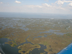
Conservationists say the Mississippi River Gulf Outlet is hastening the demise of these wetlands, leaving New Orleans without its natural buffer against hurricanes. (Photo: Jeff Young)
YOUNG: Still not easy to talk about this, huh?
DUFRECHOU: There’s a part of me that stopped living on August 29 and another part that’s still here. The part that’s still here is the part that knows we can change it, that we can make this community sustainable, and we can do it right. Um, (sigh) and dadgummit, we’re gonna do it!
YOUNG: Emotion still rides just under the surface here. A conversation can veer from hope to despair and back again. The storm made the mistakes of the past painfully clear. But it also strengthened those who would correct them. For Living on Earth, I’m Jeff Young in New Orleans.
Related links:
- John Barry’s book "Rising Tide:The Great Mississippi Flood of 1927 and How it Changed America"
- U.S. Army Corps of Engineers Improvements to New Orleans’ Hurricane Protection System
- University of Maryland – Working Group for Post-Hurricane Planning for the Louisiana Coast
- U.S. Government Accountability Office report on Hurricane Protection System
[MUSIC: Lucinda Williams "Lake Charles" from ‘Car Wheels On A Gravel Road’ (UMG Recordings - 1998)]
CURWOOD: Just ahead: we meet some folks with big ideas about how to protect New Orleans and Southern Louisiana from future storms. Keep listening to Living on Earth.
ANNOUNCER: Support for NPR comes from NPR stations and: The Charles Stewart Mott Foundation, online at M-O-T-T dot org; supporting efforts to promote a just, equitable and sustainable society; The Kresge Foundation, investing in nonprofits to help them catalyze growth, connect to stakeholders, and challenge greater support. On the web at Kresge dot org; and, the Kellogg Foundation, helping people help themselves by investing in children, their families, and their communities. On the web at W-K-K-F dot org. This is NPR, National Public Radio.
[MUSIC: Peter Case "When The Catfish Is In Bloom" from ‘I Am The Resurrection: A Tribute To John Fahey’ (Vanguard - 2006)]
Future Outlook
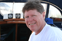
Ivor van Heerden, deputy director of the Louisiana State University Hurricane Center, at the helm of his sailboat, "The Magnum." (Photo: Steve Curwood)
[SOUND OF CONSTRUCTION VEHICLES]
CURWOOD: It’s Living on Earth, I’m Steve Curwood in New Orleans.
[SOUND OF CONSTRUCTION VEHICLES]
CURWOOD: Here at the 17th Street canal – where a year ago raging storm waters broke through the levee and ravaged a neighborhood – the Army Corps of Engineers is putting the finishing touches on repairs to the sea walls that failed during Hurricane Katrina. The Corps says the levees will hold: but for how long? Levees are the last of three lines of defense against storms. Along the Louisiana coast sinking land, rising sea levels and navigational canals are combining to drown barrier islands and turn marshland into open water. Every year 24 square miles are lost. Since 1932, a landmass the size of Delaware has disappeared. And unless – and until – Louisiana’s coastline is restored, many scientists say New Orleans will remain as vulnerable as it was before Katrina.
Ivor van Heerden, deputy director of the Louisiana State University Hurricane Center, at the helm of his sailboat, “The Magnum.” (Photo: Steve Curwood)
CURWOOD: Ivor van Heerden is deputy director of the LSU Hurricane Center and author of the new book "The Storm: What Went Wrong and Why During Hurricane Katrina." He hails from South Africa and brings with him international expertise on coastal restoration, along with the perspective of an outsider not so mired in local politics and turf wars.
In the cockpit of his sailboat, "The Magnum." van Heerden quickly lays out the foundation of what it would take to rebuild the Gulf coast in a comprehensive way that would ensure its protection.
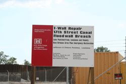
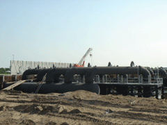
A billboard stands at the border of the massive reconstruction project headed by the U.S. Army Corps of Engineers. (Photo: Steve Curwood)
CURWOOD: Why are wetlands important for protection against hurricanes in New Orleans?
VAN HEERDEN: What we know is that a wetland reduces the storm surge because of the frictional effects as the surge moves through it. This is especially true when the surge is going through a cypress swamp because now you have trees that are at least 60 feet high, very well rooted, very well packed. So you imagine trying to push water through that forest, it slows down dramatically.
The second thing is as a hurricane approaches the coast, the right-hand side the winds are blowing to the shore, the left-hand side the winds are blowing out to sea. And so on the left-hand side you actually lower the water level so the plants and levees and the barrier islands stick up into the wind field, and as a consequence they take some of the energy out of the wind field. So the wetlands have two very important roles to play.
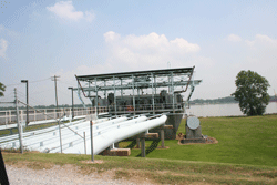
A construction crew erects new floodgates at the 17th St. Canal. (Photo: Steve Curwood)
VAN HEERDEN: The reason we’ve lost as many wetlands as we have reflects the fact that we’ve cut off the sediment supply from the Mississippi River because of the artificial levees. All that sediment now goes into Gulf waters about 400 foot deep. And in addition we’ve crisscrossed all the wetlands with numerous canals and channels, some for navigation, some for oil and gas, and they’ve totally disrupted the natural function of many of those wetlands.
CURWOOD: How difficult is it to engineer the coastal restoration and the buildup of barrier islands?
VAN HEERDEN: In terms of the barrier islands, all you need to do is move the sand from offshore about 11 miles, and then you can build up your barrier islands. There are many, many different systems. We’ve perfected beach restoration in the United States. It’s exactly the same technique.
In terms of the wetlands, we know from other examples we have in the central part of the coast that if you can just get the Mississippi water to the wetlands you’ll build little deltas, you’ll rebuild the wetlands and the whole area will rejuvenate.
Bayou LaForche, once a major branch of the Mississippi River, would get much more water under plans to restore the delta. (Photo: Steve Curwood)
He heads the coastal engineering division for the Department of Natural Resources and I met him on top of a levee in Donaldsonville, a small town on the Mississippi where both the demise of the wetlands began, but also where they may be reborn.
In 1904, the Mississippi was dammed off from the head of the Bayou LaForche, a waterway that sits just a few hundred yards from this levee. The diversion cut off fresh water, nutrients and sediment needed for the healthy survival of the estuaries systems downstream on the Gulf of Mexico, the areas experiencing the greatest rate of wetland loss.
One plan calls for a break in the levee a few miles south of where we stand. Over time this major diversion would create a new river and form a new delta. But Bob Roberts says time is running out.
ROBERTS: What we’re kinda finding out with that is it’s a long-term project. It’s on a scale that we need but in order to get it done it would take approximately 40 to 60 years for our channel to be capable of carrying the amount of water needed to build the delta, and to build delta at a rate that will help offset the loss rate that’s going on in the basins right now. And that’s what our work is showing us.
[WATER RUSHING]
The existing pumping station at Bayou LaForche. Plans are underway to build a much larger one along this levee. (Photo: Steve Curwood)
ROBERTS: It’s not a land building project, it’s mainly a freshwater and nutrient project. We don’t have the flow capacity within the bayou anymore to carry sediments long distance. But we can get the fresh water where we need it to literally keep salt water at bay and give the fresh water marsh a chance, instead of converting to a saltwater marsh or converting to open waters as a whole. The nutrients also help fertilize that marsh so that it stays healthy.
CURWOOD: But without sand and sediment there’s nothing for the water to replenish. No place to anchor the kinds of vegetation needed to dampen storm surges. That’s where Kerry St. Pe comes in.
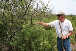
Kerry St. Pe explores the various species able to hold the wetlands in place and survive in the face of hurricanes, including a hearty variety of oak tree. (Photo: Steve Curwood)
ST. PE: Most of these are endangered birds that are flying over head. As you can see, it’s heavily used by birds for nesting.
CURWOOD: Kerry St. Pe heads the Barataria-Terrebone National Estuary Program. He leads me across acres of marsh, carefully pointing out the well-camouflaged eggs of nesting birds, coyotes tracks and sprawling vegetation. A bevy of willets, least terns, and Wilson’s plovers swirl overhead.
With butterflies lazily floating among flowering bushes and plants, it’s hard to imagine that two major hurricanes, Katrina and Rita, roared through here just several months ago. St. Pe and his partner, Dean Blanchard, take me to the top of an eight foot high ridge, a ridge that just five years ago didn’t exist.

Bayou LaForche, once a major branch of the Mississippi River, would get much more water under plans to restore the delta. (Photo: Steve Curwood)
CURWOOD: Using a system of pipes and hydraulic pumps, the St. Pe team scooped up sediments from a dredging operation at nearby Port Fourchon and piled them up where the old photos directed them. Then teams went in to plant a variety of grasses, shrubs and trees, looking for species that can flourish in the harsh environment.
[FOOTSTEPS]
St. PE: We always get our picture with Dean next to this tree. That’s how we can show it from year to year how it’s changed. This one actually had acorns on it. It was stressed pretty badly. It was totally brown after Rita. But you can see there’s a lot of new growth. It’s doing quite well. It’s gonna come back.
CURWOOD: Acorns out here where there used to just be water?
ST. PE: Yes.
CURWOOD: Now you have trees.
St. PE: Now we have trees. That’s the whole idea – building land out of open water. That’s what we need to do in Louisiana on a large scale, quickly.
CURWOOD: So you have a plan to take what you have modeled here and turn this into thousands of acres here in the Mississippi delta area. How’re you going to do this?
ST. PE: Well, we would build a system of hopefully permanent pipelines that would radiate from the Mississippi River from places of deposition, from point bars. You would harvest sediments, use what you can from that site, and move to another site, allowing the other spot in the river that you just harvested to repopulate or resettle sediments. We would look at the offshore sources where, as we’re standing here, we are within a mile from the Gulf of Mexico. There are sediment sand deposits in the Gulf of Mexico that we could use, and we would use that to build our barrier islands, for example.
CURWOOD: There’s a saying around here, what, Louisianans know how to do best, that is.
ST. PE: Well, we’ve certainly laid down a few pipelines in Louisiana and, of course, that’s to transport petroleum largely. And let me just point out that when we initially brought this up we were told that we didn’t…the technology to pump great distances really didn’t exist. And my response was, ‘well, gee, you know, we’re pumping a substance of similar thickness and viscosity all over the United States, and we call that oil. Certainly we can pump a solution of muddy water, you know, 40 or 50 miles without any problems.’
CURWOOD: There are folks who say "Hey, wait a second, why not have Mother Nature do this? but help her a little bit by making another diversion of the Mississippi, a grand diversion, a third diversion which would slow the Mississippi down and the sediment would naturally come out into these areas and create these wetlands without this high-tech approach of having to build a big super pipeline or sets of pipelines?"
ST. PE: Well, there has been examinations of a major new diversion from the Mississippi River. And so far, the data that has come out of these studies and evaluations indicates that it would take 60 years before we start actually transporting sediments here. We clearly do not have 60 years. In the short term, this pipeline thing is the only way that we can strategically build land exactly where we need it. It is the only way unless someone can point to something that we have not thought of, that no one has thought of. It is the only way that we can build land in the short term.
CURWOOD: If Kerry St. Pe is right – and he has hard ground to prove his point – it could be possible to pipe in enough sediment to make a major difference on the Louisiana coast. But it will be an uphill battle. With global warming, sea levels are projected to rise faster than they have in recent years, and the rate of increase may be dramatic. Again, Ivor van Heerden of the LSU Hurricane Center.
VAN HEERDEN: Louisiana’s been subsiding since time began. So, sea level’s been rising for a long, long time; we’ve always managed to deal with it. We just gotta get smart. We gotta recognize that if we build the right levee systems, get the wetlands healthy and get them starting to procreate again, and rebuild the barrier islands, that we can come up with a system that, like the Dutch, could give us one in 10,000 years protection.
The other important thing is New Orleans is the testing ground for the rest of the coastal United States. You know, as sea level rises it’s not just going to be New Orleans that’s gonna have a problem – it’s gonna be Tampa, Long Island, maybe parts of New York, Houston, Galveston, Port Arthur, Texas. All these areas that could in due course have to build their own levee system.
CURWOOD: From what you understand, what’s necessary to put a system in the Gulf Coast region around New Orleans that would provide as much protection as the Dutch 10,000 year system?
VAN HEERDEN: All it requires is the willpower to do it. The United States is a very, very rich country. We’re talking about to get all of coastal Louisiana their so-called category 5 protection, and rebuild all the wetlands and the barrier islands so we keep the productive fishery going, we keep the oil and gas infrastructure safe – we’re talking about 30 billion dollars. Katrina was a 300 billion dollar disaster. So, you know, it’s almost just a few cents on the dollar really to get the protection we need.
CURWOOD: Now, some people say that over the long haul people need to think about giving much of the south coast of Louisiana back to the ocean…retreating in from where people are now today. What kind of sense does that make to you, if any?
VAN HEERDEN: Well, the plan I was outlining does require some retreat from the coast. Because, right now, if you look at coastal Louisiana and imagine you spread the fingers of your hand in front of you, our levee systems kind of run along the outside of your fingers. And between each finger you have a "v" and that’s basically a funnel that a surge can funnel up when we get a big storm. So really what we need to do in terms of that finger is to cut it off at the knuckles and have one line of levees. It’s much shorter in the long run but it runs across the central part of the coastal zone. Those areas that are outside, you have to compensate the people and give them locations inside the protected system.
CURWOOD: How many people right now live outside the protected system you’re talking about?
VAN HEERDEN: It probably amounts to maybe 100,000 at the most. The bottom line in all of this as you plan is it has to be a case of not what’s good for me, but what’s good for everybody. What makes the best sense for the overall population in coastal Louisiana.
CURWOOD: In the months and years ahead that will be the central question Louisianans and the rest of the nation must grapple with. And the merits of the civil and social engineering plans to protect New Orleans and its surrounding coastline will be hotly debated. This question about coastal protection has been going on for decades, at local, state and federal levels, with many proposals but not much action to address future storms.
But Katrina and Rita brought one unwelcome answer for civil engineers and politicians alike. To do nothing, to reach no consensus, to make no decision is, in fact, a decision. One that will continue to leave the region vulnerable to the ferocious storms that push in from the Gulf of Mexico.
[MUSIC: Bessie Smith "Backwater Blues" from ‘The Essential Bessie Smith’ (Sony – 1934)]
Related links:
- Louisiana State University Hurricane Center
- Ivor van Heerden’s book "The Storm: What Went Wrong and Why During Hurricane Katrina"
- LSU Center for the Study of Public Health Impacts of Hurricanes
- Louisiana Department of Natural Resources
- Barataria-Terrebonne National Estuary Program
CURWOOD: Our program is produced by the World Media Foundation at the Jennifer and Ted Stanley studios in Somerville, Massachusetts. Chris Ballman produced and Eileen Bolinsky and Ingrid Lobet edited our Gulf Coast special. Our researcher is Emily Taylor and our technical director is Dennis Foley. Alison Lirish Dean composed our themes. You can find us at loe dot org. I’m Steve Curwood. Thanks for listening.
[MUSIC: Bessie Smith "Backwater Blues" from ‘The Essential Bessie Smith’ (Sony – 1934)]
ANNOUNCER: Funding for Living on Earth comes from the National Science Foundation, supporting coverage of emerging science; And Stonyfield farm Organic yogurt and smoothies. Stonyfield pays its farmers not to use artificial growth hormones on their cows. Details at Stonyfield dot com. Support also comes from NPR member stations, the Ford Foundation, the Town Creek Foundation, and the Saunders Hotel Group of Boston's Lennox and Copley Square Hotels. Serving you and the environment while helping preserve the past and protect the future, 800-225-7676.
ANNOUNCER2: This is NPR. National Public Radio.
Living on Earth wants to hear from you!
Living on Earth
62 Calef Highway, Suite 212
Lee, NH 03861
Telephone: 617-287-4121
E-mail: comments@loe.org
Newsletter [Click here]
Donate to Living on Earth!
Living on Earth is an independent media program and relies entirely on contributions from listeners and institutions supporting public service. Please donate now to preserve an independent environmental voice.
NewsletterLiving on Earth offers a weekly delivery of the show's rundown to your mailbox. Sign up for our newsletter today!
![]() Sailors For The Sea: Be the change you want to sea.
Sailors For The Sea: Be the change you want to sea.
 The Grantham Foundation for the Protection of the Environment: Committed to protecting and improving the health of the global environment.
 Contribute to Living on Earth and receive, as our gift to you, an archival print of one of Mark Seth Lender's extraordinary wildlife photographs. Follow the link to see Mark's current collection of photographs.
 Buy a signed copy of Mark Seth Lender's book Smeagull the Seagull & support Living on Earth
© Copyright World Media Foundation. All Rights Reserved
Home | Contact | RSS | Donate | Newsletter